Welcome To Hike Los Padres!
User Log In or Sign Up
Use Marker Cluster
Markers: Use Marker Groups
Time used: ms
Routes
    Trails
    OHV Trails
    Forest Roads
    Streams
Wildfire Layers
    Wolf 2002
    Piru 2003
    Day 2006
    Zaca 2007
    Gap 2008
    La Brea 2009
Forest Layers
    Forest Boundary
    Wilderness Areas
    Ranger Districts
    Counties
    Topographic Outlines
    Trailheads
    OHV Trailheads
Helpful Hints
    ↣ Right click the map for location data. ↣ Click a stream for Water Stats.

Upper Santa Ynez Camp South Los Padres National Forest

  • Camp Type: Trail Camp
  • Topo Map Link: White Ledge Peak
  • Elevation: 2926 feet
  • Wilderness Area: Non Wilderness Area
  • County: Santa Barbara County
  • Ranger District: Santa Barbara Ranger District
  • Longitude: -119.4519015
  • Latitude: 34.4917835
  • Water Sources: The camp is above a normally reliable tributary of the Santa Ynez River.
  • Length of Stay: 14 Days
  • Reservations: Trail Camp

Recent Water Reports:

Date Surveyor Water Report
01-10-2025Rich SchollFlowing
01-02-2025R. ZukorFlowing
12-14-2024Antonio CalderonFlowing
05-31-2024Loren Butler Flowing
08-20-2022Mark FinsterDry
06-03-2022pmeyerFlowing
04-29-2022Ojai Valley School Lower CampusFlowing
04-08-2022Anonymous SurveyorFlowing
04-02-2022A. LeupoldFlowing
02-14-2022Anonymous SurveyorFlowing
01-23-2022norman93001Flowing
08-21-2021Quentin WilliamsTrickle
07-25-2021Keith Flowing
06-21-2021Mateusz BFlowing
05-25-2021Anonymous SurveyorFlowing
05-08-2021CamelFlowing
04-10-2021DoggerFlowing
02-28-2021Anonymous SurveyorFlowing
01-09-2021Stephen SFlowing
07-10-2020Anonymous SurveyorFlowing
02-29-2020Sam McCoyFlowing
05-25-2019Chris BFlowing
11-10-2018Marin SigurdsonFlowing
05-21-2017Los Padres Forest AssociationFlowing
05-13-2017Anonymous SurveyorFlowing
10-22-2016Craig R. CareyTrickle
06-18-2016James WapotichTrickle
02-13-2016Shaddus Maximus Flowing
01-28-2016Los Padres Forest AssociationFlowing
01-17-2016Shaddus Maximus Flowing
01-03-2016Valerie NortonFlowing
03-13-2015Los Padres Forest AssociationFlowing
03-13-2015Jeff B.Flowing
06-25-2014Richard HumphreyStagnant
04-11-2014LPFAFlowing

Description:

Upper Santa Ynez Camp is set along the Forest Service access road that leads from Juncal up to Murietta Divide and down to Matilija.  This road is called either Juncal Road or Murietta Road.  The camp has very reliable water and a few small pools, although it can go dry during drought years.  There are a few old campfire rings and a table at the camp.  Upper Santa Ynez Camp is most often used by mountain bikers who ride from Matilija Canyon or Romero Saddle.  It's a nice quiet camp, under oak trees, next to a creek, and with nice views of the farthest upper sections of the Santa Ynez River Valley.

Survey Photos:

  • Jeff B. - 03-13-2015
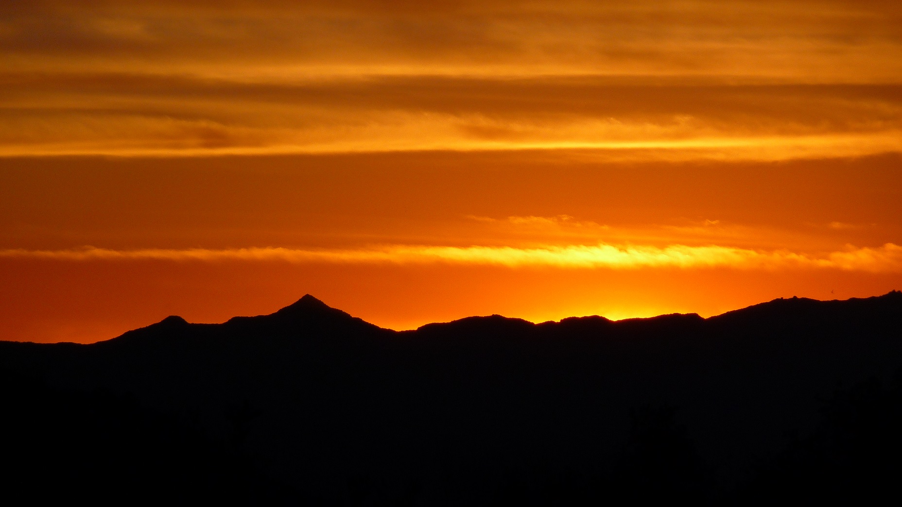
    Sunset from just above Upper Santa Ynez Camp

  • Los Padres Forest Association - 01-28-2016

  • Los Padres Forest Association - 01-28-2016

  • Craig R. Carey - 10-22-2016

  • Craig R. Carey - 10-22-2016

  • Los Padres Forest Association - 05-21-2017
    Photo Humphrey

  • Los Padres Forest Association - 05-21-2017
    Photo Humphrey

  • Stephen S - 01-09-2021

  • Stephen S - 01-09-2021

  • Dogger - 04-10-2021
    camp in good shape. lots of poison oak outside of immediate camp.

  • Mateusz B - 06-21-2021

  • Mateusz B - 06-21-2021

  • Mateusz B - 06-21-2021

  • Keith - 07-25-2021

  • A. Leupold - 04-02-2022

  • pmeyer - 06-03-2022

  • pmeyer - 06-03-2022

  • pmeyer - 06-03-2022

  • Loren Butler - 05-31-2024

  • Antonio Calderon - 12-14-2024

  • R. Zukor - 01-02-2025

Submitted Camp Reports

Upper Santa Ynez Camp Survey - 01-10-2025 - by Rich Scholl
Link: Upper Santa Ynez Camp
Date: 01-10-2025
Surveyor Name:Rich Scholl
Camp Description:Travelled by ebike E. Camino Cielo to Ojai via Murieta Pass on 1/10/25.  Juncal to alder crk. flume road good. road beyond Jameson to Murieta Pass deteriorated to rough singletrack.  Upper S. Ynez camp in good shape. Road from Murieta Pass to Matilija -DON'T EVEN TRY IT-many rocky outwashes to climb over, one long section worse than nonexistent-a steep boulder strewn creekbed, a deep arroyo cut across "road" passable by a very sketchy trail. Upper and lower approaches to Murieta camp not found.
Water Source:Flowing
Water Source Details:
Weather Conditions:perfect
Upper Santa Ynez Camp Survey - 01-02-2025 - by R. Zukor
Link: Upper Santa Ynez Camp
Date: 01-02-2025
Surveyor Name:R. Zukor
Camp Description:Camp is in good shape. 
Water Source:Flowing
Water Source Details:Good clean flow.
Weather Conditions:Clear and mild
Images:

Upper Santa Ynez Camp Survey - 12-14-2024 - by Antonio Calderon
Link: Upper Santa Ynez Camp
Date: 12-14-2024
Surveyor Name:Antonio Calderon
Camp Description:
Water Source:Flowing
Water Source Details:
Weather Conditions:65 F, Drizzle
Images:

Upper Santa Ynez Camp Survey - 05-31-2024 - by Loren Butler
Link: Upper Santa Ynez Camp
Date: 05-31-2024
Surveyor Name:Loren Butler
Camp Description:Camp is in generally good shape, though a large oak fell between the camp and the road; if one hadn't been to the camp before, it could be quite easy to miss. The creek is flowing at high volume and water is cold and delicious. 
Water Source:Flowing
Water Source Details:Flowing beautifully.
Weather Conditions:
Images:

Upper Santa Ynez Camp Survey - 08-20-2022 - by Mark Finster
Link: Upper Santa Ynez Camp
Date: 08-20-2022
Surveyor Name:Mark Finster
Camp Description:
Water Source:Dry
Water Source Details:
Weather Conditions:
Upper Santa Ynez Camp Survey - 06-03-2022 - by pmeyer
Link: Upper Santa Ynez Camp
Date: 06-03-2022
Surveyor Name:pmeyer
Camp Description:Beautiful camp in a shaded section of the canyon. Unfortunately somebody left a bunch of their stuff there. 
Water Source:Flowing
Water Source Details:Not a robust flow, but a flow
Weather Conditions:Sunny, ~75 degrees
Images:


Upper Santa Ynez Camp Survey - 04-29-2022 - by Ojai Valley School Lower Campus
Link: Upper Santa Ynez Camp
Date: 04-29-2022
Surveyor Name:Ojai Valley School Lower Campus
Camp Description:
Water Source:Flowing
Water Source Details:Cute camp on a reliable creek. Small pool nearby. Room for a couple of tents.
Weather Conditions:
Upper Santa Ynez Camp Survey - 04-08-2022 - by Anonymous Surveyor
Link: Upper Santa Ynez Camp
Date: 04-08-2022
Surveyor Name:Anonymous Surveyor
Camp Description:The water is still very good and flowing clean. There is poison oak starting to become a bigger issue for water access from the actual camp and poison oak looks to be starting to take over the camp site itself.
Water Source:Flowing
Water Source Details:Full flowing stream, clear cool smells good
Weather Conditions:
Upper Santa Ynez Camp Survey - 04-02-2022 - by A. Leupold
Link: Upper Santa Ynez Camp
Date: 04-02-2022
Surveyor Name:A. Leupold
Camp Description:The water just before the campsite is flowing well at this time, it is crossing the trail and flowing into the larger pool at a good rate. I was able to easily collect water flowing over the edge to run through my filter. The weather was amazing at around 65-67 degrees, light wind, partly cloudy. 
Water Source:Flowing
Water Source Details:
Weather Conditions:
Images:

Upper Santa Ynez Camp Survey - 02-14-2022 - by Anonymous Surveyor
Link: Upper Santa Ynez Camp
Date: 02-14-2022
Surveyor Name:Anonymous Surveyor
Camp Description:
Water Source:Flowing
Water Source Details:Clear, cold, flowing highly serviceable
Weather Conditions:85-90F clear with a breeze
Upper Santa Ynez Camp Survey - 01-23-2022 - by norman93001
Link: Upper Santa Ynez Camp
Date: 01-23-2022
Surveyor Name:norman93001
Camp Description:
Water Source:Flowing
Water Source Details:
Weather Conditions:
Upper Santa Ynez Camp Survey - 08-21-2021 - by Quentin Williams
Link: Upper Santa Ynez Camp
Date: 08-21-2021
Surveyor Name:Quentin Williams
Camp Description:Came through here on a bikepacking trip. Divide peak and down Monte Arido trail to Murrieta Divide.

Water Source:Trickle
Water Source Details:There was just a trickle of water flowing over the trail. Not sure how long this water will lasts.
Weather Conditions:
Upper Santa Ynez Camp Survey - 07-25-2021 - by Keith
Link: Upper Santa Ynez Camp
Date: 07-25-2021
Surveyor Name:Keith
Camp Description:Started at Matilija and ended up at the top of Romero. 
Water Source:Flowing
Water Source Details:Decent flow. Perfect for filtering water.
Weather Conditions:Sunny, 100F.
Images:

Upper Santa Ynez Camp Survey - 06-21-2021 - by Mateusz B
Link: Upper Santa Ynez Camp
Date: 06-21-2021
Surveyor Name:Mateusz B
Camp Description:Rode past camp. Was able to have lunch, filter, and fill up at stream on the road just outside of camp.  Was going to and from little caliente hot springs. 

Someone left a camping chair at camp. 
Water Source:Flowing
Water Source Details:Good flow for filling water bottles
Weather Conditions:
Images:


Upper Santa Ynez Camp Survey - 05-25-2021 - by Anonymous Surveyor
Link: Upper Santa Ynez Camp
Date: 05-25-2021
Surveyor Name:Anonymous Surveyor
Camp Description:From an avid mountain biker to the scumbag cyclists who left your trash at Upper Santa Ynez Camp on the evening of Saturday 5/22/21: I sincerely hope each and every one of you wiped your asses with poison oak. Your lack of respect is appalling.
Water Source:Flowing
Water Source Details:
Weather Conditions:
Upper Santa Ynez Camp Survey - 05-08-2021 - by Camel
Link: Upper Santa Ynez Camp
Date: 05-08-2021
Surveyor Name:Camel
Camp Description:Great shady camp with a picnic table and fire ring/grill, room for 2-3 tents.  Poison oak around the perimeter, mostly on the creek side.
Water Source:Flowing
Water Source Details:Clear flowing water, shallow at the road crossing but with pools up and downstream
Weather Conditions:Hot and sunny
Upper Santa Ynez Camp Survey - 04-10-2021 - by Dogger
Link: Upper Santa Ynez Camp
Date: 04-10-2021
Surveyor Name:Dogger
Camp Description:
Water Source:Flowing
Water Source Details:
Weather Conditions:highs in 70’s, lows in 50’s. clear. faint breeze.
Images:

camp in good shape. lots of poison oak outside of immediate camp.
Upper Santa Ynez Camp Survey - 02-28-2021 - by Anonymous Surveyor
Link: Upper Santa Ynez Camp
Date: 02-28-2021
Surveyor Name:Anonymous Surveyor
Camp Description:
Water Source:Flowing
Water Source Details:Flowing water, plenty of water to drink (filtered)
Weather Conditions:
Upper Santa Ynez Camp Survey - 01-09-2021 - by Stephen S
Link: Upper Santa Ynez Camp
Date: 01-09-2021
Surveyor Name:Stephen S
Camp Description:Camp was in good shape with water flowing in the creek. Lots of shade with one picnic table.

Hiked to the camp as part of a loop from Romero Saddle.
Water Source:Flowing
Water Source Details:Good flow with some small pools next to camp. One large pool downstream of the road crossing.
Weather Conditions:Clear and sunny. Mid 60s.
Images:


Upper Santa Ynez Camp Survey - 07-10-2020 - by Anonymous Surveyor
Link: Upper Santa Ynez Camp
Date: 07-10-2020
Surveyor Name:Anonymous Surveyor
Camp Description:
Water Source:Flowing
Water Source Details:Deep pool right off trail to wade in
Weather Conditions:90+
Upper Santa Ynez Camp Survey - 02-29-2020 - by Sam McCoy
Link: Upper Santa Ynez Camp
Date: 02-29-2020
Surveyor Name:Sam McCoy
Camp Description:Small site with one picnic table and one fire pit.
Water Source:Flowing
Water Source Details:
Weather Conditions:
Upper Santa Ynez Camp Survey - 05-25-2019 - by Chris B
Link: Upper Santa Ynez Camp
Date: 05-25-2019
Surveyor Name:Chris B
Camp Description:Camp is well shaded, picnic table is still there. Pretty heavy overgrowth around camp site, still some space for tents. 
Water Source:Flowing
Water Source Details:Steady flow, easy access for water for filtration.
Weather Conditions:
Upper Santa Ynez Camp Survey - 11-10-2018 - by Marin Sigurdson
Link: Upper Santa Ynez Camp
Date: 11-10-2018
Surveyor Name:Marin Sigurdson
Camp Description:Although camp was damaged in Thomas fire, its still got water, a picnic table (just one end was burnt off), and flat spots for tents. No weed abatement however means wading through stickers to get to the camp. Poison oak was burnt away but is springing back up everywhere. Warm this November evening. Wind gusted high above but didn't reach the camp much. 
Water Source:Flowing
Water Source Details:Plenty of water for filtering. Flowing Trickle.
Weather Conditions:
Upper Santa Ynez Camp Survey - 05-21-2017 - by Los Padres Forest Association
Link: Upper Santa Ynez Camp
Date: 05-21-2017
Surveyor Name:Los Padres Forest Association
Camp Description:Volunteer Wilderness Ranger project to clean up the camp, paint the tables and check on the status of the camp.  Lots of bugs, camp is clean and in good shape.
Water Source:Flowing
Water Source Details:
Weather Conditions:91 degrees and buggy
Images:

Photo Humphrey

Photo Humphrey
Upper Santa Ynez Camp Survey - 05-13-2017 - by Anonymous Surveyor
Link: Upper Santa Ynez Camp
Date: 05-13-2017
Surveyor Name:Anonymous Surveyor
Camp Description:Good clean campsite.  The wind sounded like it was going to blow my tent over.  The site is kind of out of sight but there grass is thinner on the track.  That's how I ended up finding it.  Lots of tall grass around the campsite but there is a good clearing. 
Water Source:Flowing
Water Source Details:Water was clear and flowing
Weather Conditions:Sunny and 70s during day, 50s at night and windy
Upper Santa Ynez Camp Survey - 10-22-2016 - by Craig R. Carey
Link: Upper Santa Ynez Camp
Date: 10-22-2016
Surveyor Name:Craig R. Carey
Camp Description:Still a tad buggy, but a great weekend with Troop 111 at Upper Santa Ynez. 
Water Source:Trickle
Water Source Details:Clear and cold.
Weather Conditions:
Images:


Upper Santa Ynez Camp Survey - 06-18-2016 - by James Wapotich
Link: Upper Santa Ynez Camp
Date: 06-18-2016
Surveyor Name:James Wapotich
Camp Description:There is a trickle of water in the creek at the crossing near the camp, with refreshingly cold water in the pool. The camp however is buggy this time of year, better to wait until it gets too cold for them to camp there.
Water Source:Trickle
Water Source Details:
Weather Conditions:
Upper Santa Ynez Camp Survey - 02-13-2016 - by Shaddus Maximus
Link: Upper Santa Ynez Camp
Date: 02-13-2016
Surveyor Name:Shaddus Maximus
Camp Description:
Water Source:Flowing
Water Source Details:
Weather Conditions:
Upper Santa Ynez Camp Survey - 01-28-2016 - by Los Padres Forest Association
Link: Upper Santa Ynez Camp
Date: 01-28-2016
Surveyor Name:Los Padres Forest Association
Camp Description:Good water.
Water Source:Flowing
Water Source Details:
Weather Conditions:
Images:


Upper Santa Ynez Camp Survey - 01-17-2016 - by Shaddus Maximus
Link: Upper Santa Ynez Camp
Date: 01-17-2016
Surveyor Name:Shaddus Maximus
Camp Description:
Water Source:Flowing
Water Source Details:
Weather Conditions:
Upper Santa Ynez Camp Survey - 01-03-2016 - by Valerie Norton
Link: Upper Santa Ynez Camp
Date: 01-03-2016
Surveyor Name:Valerie Norton
Camp Description:Walked the road up to Murrietta Divide and stopped by on my way up.
Water Source:Flowing
Water Source Details:
Weather Conditions:upper 60s and windy, camp sheltered
Upper Santa Ynez Camp Survey - 03-13-2015 - by Los Padres Forest Association
Link: Upper Santa Ynez Camp
Date: 03-13-2015
Surveyor Name:Los Padres Forest Association
Camp Description:Other than at USY Camp, there is no water along the Santa Ynez above Jameson Lake.  There is good water at Juncal. 
Water Source:Flowing
Water Source Details:
Weather Conditions:
Upper Santa Ynez Camp Survey - 03-13-2015 - by Jeff B.
Link: Upper Santa Ynez Camp
Date: 03-13-2015
Surveyor Name:Jeff B.
Camp Description:Quick one-night bikepacking trip, Lower Oso-Upper Santa Ynez and return the next day. Camp is in great shape, with very little sign of recent use when I was there; road up from Juncal Gate in very good condition.
Water Source:Flowing
Water Source Details:Plenty of deliciously cool flowing water.
Weather Conditions:
Images:

Sunset from just above Upper Santa Ynez Camp
Upper Santa Ynez Camp Survey - 06-25-2014 - by Richard Humphrey
Link: Upper Santa Ynez Camp
Date: 06-25-2014
Surveyor Name:Richard Humphrey
Camp Description:Upper Santa Ynez! The Spring is now stagnant ok, bring extra h20 if you are hIking or mountain biking ok!]]Lot of black flies up there right now, bring repellant, etc ok! Be smart whether hiking or mountain biking there ok!  don't count on h20 up on the upper Ynez Spring ok, i doubt i would even pump this for h20 ok! Leprechaun SB!
Water Source:Stagnant
Water Source Details:Went in to Upper Santa Ynez Camp last Wednesday afternoon, I arrived at the camp site and was surprised to see that the Spring was now stagnant and not flowing, key info for our local mountain bikers ok! the campsite is quite dry during this exceptionasl drought, those folks hiking or riding in should be their needed h20 ok! it's only gonna get worse from here on out this season, use common sense! exspect no water sources up in the Upper Santa Ynez Camp site ! The Jeepway is in good enough
Weather Conditions:82-88 degrees day time, 48 nights...
Upper Santa Ynez Camp Survey - 04-11-2014 - by LPFA
Link: Upper Santa Ynez Camp
Date: 04-11-2014
Surveyor Name:LPFA
Camp Description:
Water Source:Flowing
Water Source Details:Water flowing at the camp but no water along the creek above Jameson Lake.
Weather Conditions:

Leave A Camp Report

Survey / Report Form


Last Updated: Friday, January 20, 2023

Join Our Mailing List
×
Get updates on conditions, surveys and more...

L.P.N.F. Contacts »

  • Forest Headquarters
    Phone: (805) 968-6640
  • Mt. Pinos District
    Phone: (661) 245-3731
  • Ojai Ranger District
    Phone: (805) 646-4348
  • Santa Barbara District
    Phone: (805) 967-3481
  • Santa Lucia District
    Phone: (805) 925-9538
  • Monterey District
    Phone: (831) 385-5434