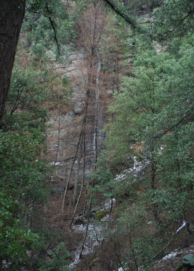
Welcome To Hike Los Padres!
User Log In or Sign Up
Use Marker Cluster
Markers: Use Marker Groups
Time used: ms
Routes
    Trails
    OHV Trails
    Forest Roads
    Streams
Wildfire Layers
    Wolf 2002
    Piru 2003
    Day 2006
    Zaca 2007
    Gap 2008
    La Brea 2009
Forest Layers
    Forest Boundary
    Wilderness Areas
    Ranger Districts
    Counties
    Topographic Outlines
    Trailheads
    OHV Trailheads
Helpful Hints
    ↣ Right click the map for location data. ↣ Click a stream for Water Stats.

Lower Bear Camp South Los Padres National Forest

  • Camp Type: Wilderness Trail Camp
  • Topo Map Link: Big Pine Mountain
  • Elevation: 4744 feet
  • Wilderness Area: San Rafael
  • County: Santa Barbara County
  • Ranger District: Santa Lucia Ranger District
  • Longitude: -119.64438021183014
  • Latitude: 34.71278287110687
  • Water Sources: Lower Bear is at the headwaters of the Sisquoc River and ALWAYS has good water flowing right next to the camp.
  • Length of Stay: 14 Days
  • Reservations: Wilderness Trail Camp

Recent Water Reports:

Date Surveyor Water Report
01-01-2025Brian D'AmourFlowing
05-20-2022Addison JerlowFlowing
04-24-2022Ojai Valley School Lower CampusFlowing
04-15-2022Brad AndersonFlowing
03-30-2022Surly hikerFlowing
03-12-2022Anonymous SurveyorFlowing
02-05-2022Stephen SFlowing
11-26-2021Diane SoiniFlowing
04-17-2021Louis TremblayFlowing
04-05-2021Oak TitmouseFlowing
11-07-2020Nate BatesFlowing
07-04-2020Anonymous SurveyorFlowing
07-02-2020Micah SittigFlowing
06-26-2020Anonymous SurveyorFlowing
01-03-2019Brad AndersonFlowing
05-27-2018Shaddus MaximusFlowing
04-19-2018Daniel J. HallFlowing
03-27-2018Shaddus MaximusFlowing
02-25-2018BastienFlowing
03-20-2017Los Padres Forest AssociationFlowing
07-16-2016jasonn beckstrandFlowing
05-10-2016Los Padres Forest AssociationFlowing
05-07-2016James WapotichFlowing
11-14-2015Los Padres Forest AssociationFlowing
03-02-2015Bryan ConantFlowing
11-24-2014Shaddus Maximus Flowing

Description:

Lower Bear Camp, as its name indicates, is the lowest of the three Bear Camps along the upper stretches of the Sisquoc Trail (#30W12) within the San Rafael Wilderness. As a result of some older inaccurate map data, Lower Bear is sometimes incorrectly referred to as Falls Camp but rest assured that when you get to Lower Bear you will be greeted by an old metal sign with the words LOWER BEAR CAMP clearly spelled out.  

Lower Bear Camp is located at the base of the steep section of trail known as the Devil's Slide. The camp is seldom used, as most people prefer either Bear or Upper Bear but don't undersell Lower Bear as it can be the best of the three camps depending on the time of year it is visited. Lower Bear is mostly covered by a thick canopy of bay and cottonwood trees that can make it rather dark and dingy in the winter time or nice and shaded in the summer. The camp itself doesn't see much direct sunlight, which again can be a plus or a minus depending on when visited. The Sisquoc flows year round through Lower Bear Camp and has some of the better water anywhere within this portion of the Los Padres. The camp contains an icecan stove, a shovel, a bench fashioned from an old log and a camp sign.

Lower Bear is most commonly used by backpackers exploring the Upper Sisquoc or following the Condor Trail and is certainly a nice stopping point for lunch, a good place to camp or to take a breather before starting the steep climb up the Devil's Slide. While at Lower Bear, be sure to take the time to explore the nearby waterfalls as well, they are sweet and always have water.

Survey Photos:


  • Shaddus Maximus - 11-24-2014

  • Bryan Conant - 03-02-2015
    The lowest of the waterfalls along the Devils Slide, almost makes me want to remove that tree so as to make for a better photograph
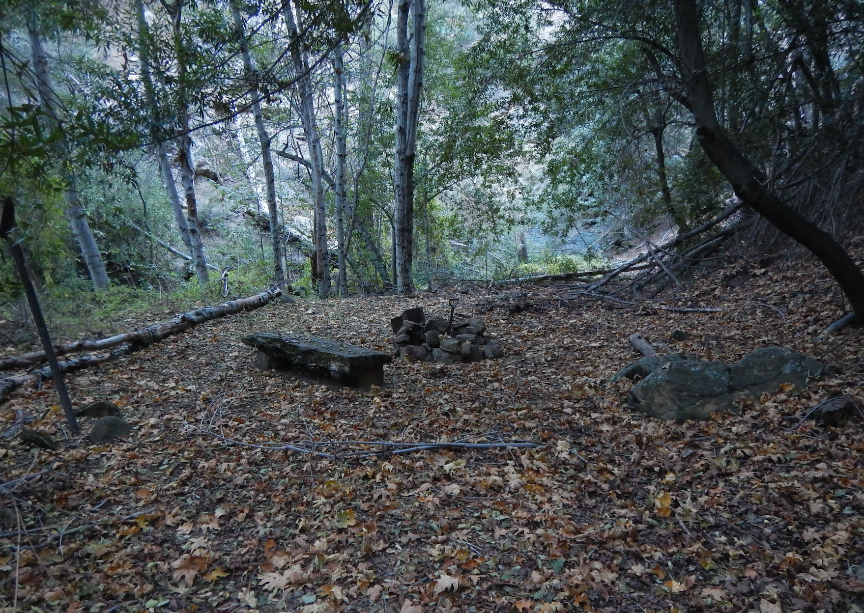
  • Los Padres Forest Association - 11-14-2015
    Lower Bear Camp, showing it's fall colors
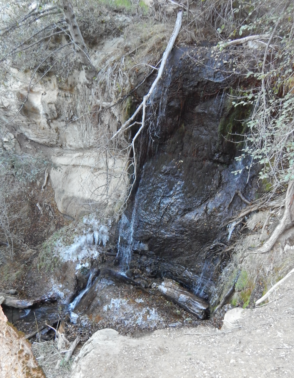
  • Los Padres Forest Association - 11-14-2015
    Frozen falls above Devil's Slide

  • Los Padres Forest Association - 03-20-2017

  • Los Padres Forest Association - 03-20-2017

  • Brad Anderson - 01-03-2019

  • Micah Sittig - 07-02-2020
    Camp as we left it the next morning.

  • Louis Tremblay - 04-17-2021

  • Anonymous Surveyor - 03-12-2022

  • Anonymous Surveyor - 03-12-2022

  • Addison Jerlow - 05-20-2022

Submitted Camp Reports

Lower Bear Camp Survey - 01-01-2025 - by Brian D'Amour
Link: Lower Bear Camp
Date: 01-01-2025
Surveyor Name:Brian D'Amour
Camp Description:
Water Source:Flowing
Water Source Details:Good flow in river near camp - river is dry just beyond the top falls
Weather Conditions:
Lower Bear Camp Survey - 05-20-2022 - by Addison Jerlow
Link: Lower Bear Camp
Date: 05-20-2022
Surveyor Name:Addison Jerlow
Camp Description:Camp in good shape. Lots of water in the creek. Saw a bear in the creek a half mile downstream.
Water Source:Flowing
Water Source Details:
Weather Conditions:low 70s
Images:

Lower Bear Camp Survey - 04-24-2022 - by Ojai Valley School Lower Campus
Link: Lower Bear Camp
Date: 04-24-2022
Surveyor Name:Ojai Valley School Lower Campus
Camp Description:
Water Source:Flowing
Water Source Details:Smaller camp near the falls. Poor bathroom conditions as the camp is sandwiched between two creeks. Concerned about contamination here.
Weather Conditions:
Lower Bear Camp Survey - 04-15-2022 - by Brad Anderson
Link: Lower Bear Camp
Date: 04-15-2022
Surveyor Name:Brad Anderson
Camp Description:Beautiful!
Water Source:Flowing
Water Source Details:Water is flowing!
Weather Conditions:
Lower Bear Camp Survey - 03-30-2022 - by Surly hiker
Link: Lower Bear Camp
Date: 03-30-2022
Surveyor Name:Surly hiker
Camp Description:Beautiful, shady camp next to the creek with view of the waterfall.a little wet due to recent rain an shade.
Water Source:Flowing
Water Source Details:A few inches of good flow in the creek and waterfall spilling!
Weather Conditions:60s during the day, 30s? at night.
Lower Bear Camp Survey - 03-12-2022 - by Anonymous Surveyor
Link: Lower Bear Camp
Date: 03-12-2022
Surveyor Name:Anonymous Surveyor
Camp Description:Falls were flowing. Creek crossings between Heath and Bear have poison oak. Camp is in good shape. 2-4 small tents can fit. Fire pit was in good condition. Small stack of cut logs. Trail between lower and middle bear should be stabilized. Very narrow and a slip would result in a bad fall. 
Water Source:Flowing
Water Source Details:
Weather Conditions:
Images:


Lower Bear Camp Survey - 02-05-2022 - by Stephen S
Link: Lower Bear Camp
Date: 02-05-2022
Surveyor Name:Stephen S
Camp Description:
Water Source:Flowing
Water Source Details:
Weather Conditions:
Lower Bear Camp Survey - 11-26-2021 - by Diane Soini
Link: Lower Bear Camp
Date: 11-26-2021
Surveyor Name:Diane Soini
Camp Description:The camp was covered in leaves. The water fall was beautiful and the creek next to the camp was flowing. I did not camp here.
Water Source:Flowing
Water Source Details:
Weather Conditions:warm and dry
Lower Bear Camp Survey - 04-17-2021 - by Louis Tremblay
Link: Lower Bear Camp
Date: 04-17-2021
Surveyor Name:Louis Tremblay
Camp Description:Camp cleaned up and rebuilt during LFPA volunteer trip. New bench constructed and all deadfall removed/processed. Good amount of firewood available now, enjoy! 


Water Source:Flowing
Water Source Details:full flow
Weather Conditions:
Images:

Lower Bear Camp Survey - 04-05-2021 - by Oak Titmouse
Link: Lower Bear Camp
Date: 04-05-2021
Surveyor Name:Oak Titmouse
Camp Description:Lots of deadfall, not a very attractive camp.
Water Source:Flowing
Water Source Details:
Weather Conditions:
Lower Bear Camp Survey - 11-07-2020 - by Nate Bates
Link: Lower Bear Camp
Date: 11-07-2020
Surveyor Name:Nate Bates
Camp Description:
Water Source:Flowing
Water Source Details:
Weather Conditions:
Lower Bear Camp Survey - 07-04-2020 - by Anonymous Surveyor
Link: Lower Bear Camp
Date: 07-04-2020
Surveyor Name:Anonymous Surveyor
Camp Description:
Water Source:Flowing
Water Source Details:
Weather Conditions:
Lower Bear Camp Survey - 07-02-2020 - by Micah Sittig
Link: Lower Bear Camp
Date: 07-02-2020
Surveyor Name:Micah Sittig
Camp Description:First campsite with water as we walked in from Big Pine Rd, had us nervous for a bit. Camp itself is in good condition, gets dark early b/c it's in a narrow canyon with high walls. Water is very cold, there is a pool about 2 feet deep just above camp. Beautiful columbine flowers at lower access to stream. Enjoyed the full-sized, flat bench.
Water Source:Flowing
Water Source Details:Strong flow with clean water.
Weather Conditions:
Images:

Camp as we left it the next morning.
Lower Bear Camp Survey - 06-26-2020 - by Anonymous Surveyor
Link: Lower Bear Camp
Date: 06-26-2020
Surveyor Name:Anonymous Surveyor
Camp Description:
Water Source:Flowing
Water Source Details:
Weather Conditions:
Lower Bear Camp Survey - 01-03-2019 - by Brad Anderson
Link: Lower Bear Camp
Date: 01-03-2019
Surveyor Name:Brad Anderson
Camp Description:Camp is in good condition, though covered with a lot of dry leaves!
Water Source:Flowing
Water Source Details:Flowing well.
Weather Conditions:
Images:

Lower Bear Camp Survey - 05-27-2018 - by Shaddus Maximus
Link: Lower Bear Camp
Date: 05-27-2018
Surveyor Name:Shaddus Maximus
Camp Description:
Water Source:Flowing
Water Source Details:
Weather Conditions:
Lower Bear Camp Survey - 04-19-2018 - by Daniel J. Hall
Link: Lower Bear Camp
Date: 04-19-2018
Surveyor Name:Daniel J. Hall
Camp Description:
Water Source:Flowing
Water Source Details:clean flowing water
Weather Conditions:
Lower Bear Camp Survey - 03-27-2018 - by Shaddus Maximus
Link: Lower Bear Camp
Date: 03-27-2018
Surveyor Name:Shaddus Maximus
Camp Description:
Water Source:Flowing
Water Source Details:
Weather Conditions:
Lower Bear Camp Survey - 02-25-2018 - by Bastien
Link: Lower Bear Camp
Date: 02-25-2018
Surveyor Name:Bastien
Camp Description:
Water Source:Flowing
Water Source Details:
Weather Conditions:
Lower Bear Camp Survey - 03-20-2017 - by Los Padres Forest Association
Link: Lower Bear Camp
Date: 03-20-2017
Surveyor Name:Los Padres Forest Association
Camp Description:Camp in regular shape.  Dark, a little cold and a good smattering of branches and limbs that could be cleaned up or burned.  Plenty of great, nice water in both branches of the Sisquoc.  Lots of downed trees both upstream and downstream of Lower Bear.  Prepare for battle.......
Water Source:Flowing
Water Source Details:
Weather Conditions:
Images:


Lower Bear Camp Survey - 07-16-2016 - by jasonn beckstrand
Link: Lower Bear Camp
Date: 07-16-2016
Surveyor Name:jasonn beckstrand
Camp Description:lots of stinging nettles
camp clean
no signs the fire pit has been used.
Water Source:Flowing
Water Source Details:great water at next to the camp and water fall is flowing
Weather Conditions:85
Lower Bear Camp Survey - 05-10-2016 - by Los Padres Forest Association
Link: Lower Bear Camp
Date: 05-10-2016
Surveyor Name:Los Padres Forest Association
Camp Description:Great water flowing through the falls and down the Sisquoc.  No water at Bear Camp.
Water Source:Flowing
Water Source Details:
Weather Conditions:
Lower Bear Camp Survey - 05-07-2016 - by James Wapotich
Link: Lower Bear Camp
Date: 05-07-2016
Surveyor Name:James Wapotich
Camp Description:Good water in the Sisquoc from Rattlesnake Falls to above Lower Bear. Water flowing in Bear Falls.
Water Source:Flowing
Water Source Details:
Weather Conditions:
Lower Bear Camp Survey - 11-14-2015 - by Los Padres Forest Association
Link: Lower Bear Camp
Date: 11-14-2015
Surveyor Name:Los Padres Forest Association
Camp Description:LPFA trail patrol to check on the Devil's Slide for a potential future trail project.  The slide is holding up as usual.  Good water in the creek at Lower Bear and portions of the waterfalls were frozen.  Very cold down there.
Water Source:Flowing
Water Source Details:
Weather Conditions:Freezing and sunny.
Images:

Lower Bear Camp, showing it's fall colors

Frozen falls above Devil's Slide
Lower Bear Camp Survey - 03-02-2015 - by Bryan Conant
Link: Lower Bear Camp
Date: 03-02-2015
Surveyor Name:Bryan Conant
Camp Description:Hiked through Lower Bear on a 8 day backpacking trip.  It was snowing and beautiful!  Didn't stop too long but there were a few downed trees around camp blocking the water access.  Water was flowing great, but pretty week for early March compared to most years.
Water Source:Flowing
Water Source Details:
Weather Conditions:low 30's and snowing
Images:

The lowest of the waterfalls along the Devils Slide, almost makes me want to remove that tree so as to make for a better photograph
Lower Bear Camp Survey - 11-24-2014 - by Shaddus Maximus
Link: Lower Bear Camp
Date: 11-24-2014
Surveyor Name:Shaddus Maximus
Camp Description:No picnic table at Lower Bear. Doesn't look like the site has been used in quite some time.
Water Source:Flowing
Water Source Details:
Weather Conditions:
Images:


Leave A Camp Report

Survey / Report Form


Last Updated: Tuesday, July 19, 2022

Join Our Mailing List
×
Get updates on conditions, surveys and more...

L.P.N.F. Contacts »

  • Forest Headquarters
    Phone: (805) 968-6640
  • Mt. Pinos District
    Phone: (661) 245-3731
  • Ojai Ranger District
    Phone: (805) 646-4348
  • Santa Barbara District
    Phone: (805) 967-3481
  • Santa Lucia District
    Phone: (805) 925-9538
  • Monterey District
    Phone: (831) 385-5434