Welcome To Hike Los Padres!
User Log In or Sign Up
Use Marker Cluster
Markers: Use Marker Groups
Time used: ms
Routes
    Trails
    OHV Trails
    Forest Roads
    Streams
Wildfire Layers
    Wolf 2002
    Piru 2003
    Day 2006
    Zaca 2007
    Gap 2008
    La Brea 2009
Forest Layers
    Forest Boundary
    Wilderness Areas
    Ranger Districts
    Counties
    Topographic Outlines
    Trailheads
    OHV Trailheads
Helpful Hints
    ↣ Right click the map for location data. ↣ Click a stream for Water Stats.

Pino Alto Trail - Los Padres National Forest
Trail Distance .45 Miles

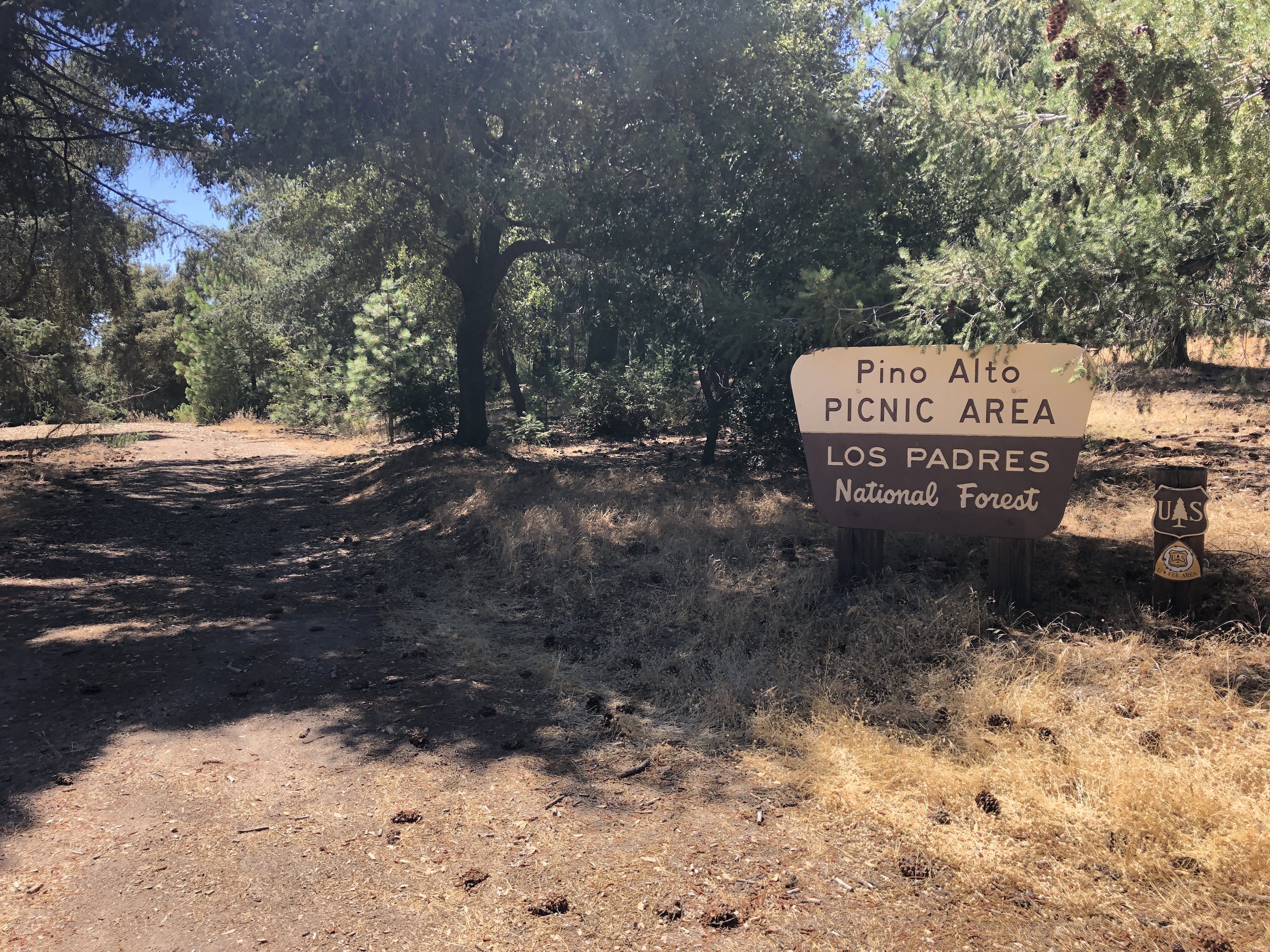
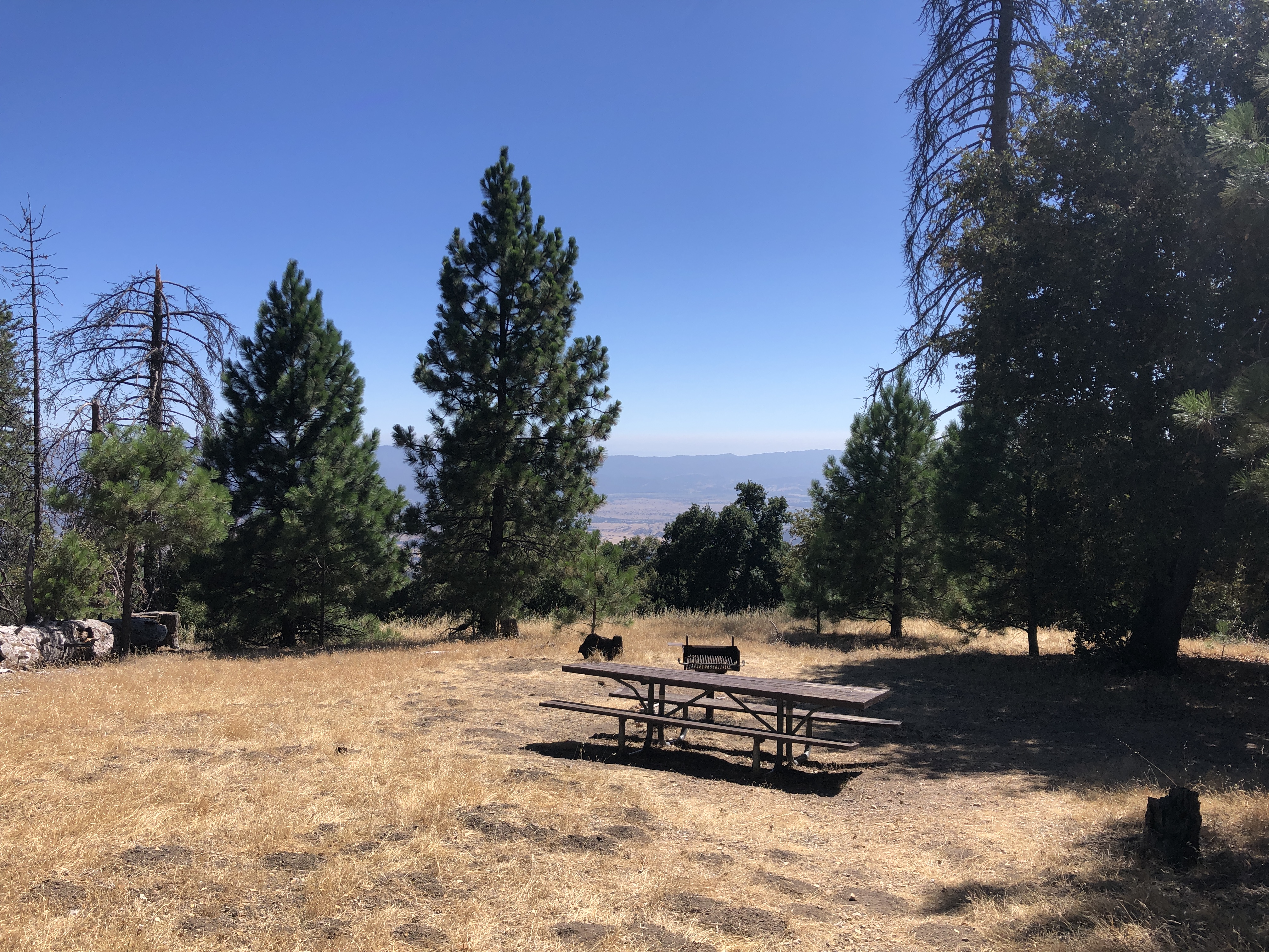
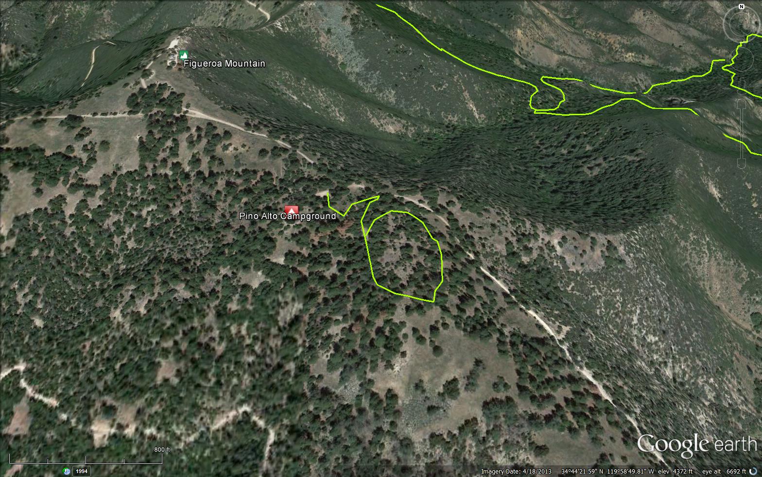
The Pino Alto Trail is a short .45 mile trail in Santa Barbara County. Located at the Pino Alto Day Use Area. The area includes a paved interpretive trail suitable for wheelchair use. The trail is one-half mile and takes 30 to 45 minutes to traverse. Interpretive brochures are available at the trailhead.

Trail Details

  • Trail #: 29W01
  • Wilderness Area: Non Wilderness Area
  • County: Santa Barbara County
  • Ranger District: Santa Lucia Ranger District
  • Trail-head Latitude: 34.74055
  • Trail-head Longitude: -119.98153
  • Trail Condition: Kind of Good - Little to no bushwacking and easily followable
  • Topo Maps:
  • Activities & Features:
    • Biking
    • Day Hiking
    • Paved Roads
    • Picnic Area
    • Wildlife Viewing


Trail Stats

  • Total Elevation Gain: + 76 feet.
  • Total Elevation Loss: - 66 feet.
  • Overall Average Slope Gain: + 5 %.
  • Overall Average Slope Loss: - 5 %.
  • Kilometers: (km)
  • Meters: (m)
  • Miles: (mi)
  • Feet: (ft)
  • Average Slope: (%)

Photo By: - Website Link

Photo By: - Website Link
Upload Images Aerial Overview Image Login to Download GPS File
Survey This Trail

Submitted Trail Reports

Pino Alto Trail Survey - 08-06-2020 - by J Gro
Link: Pino Alto Trail
Date: 08-06-2020
Surveyor Name:J Gro
Trail description:This large asphalt loop was built by locals in 1973, and is fairly decrepit; asphalt path is deteriorating & overgrown, and interpretation has been removed. Benches still remain, along with picnic tables and vault toilet. Many downed trees around the area, brush and dry vegtation collectd in piles as of early August, 2020. The road up to this trail is closed at Figueroa Mountain Road.
Mode of transport:Hike
Trail condition:Needs some work


Leave A Trail Report

Survey / Report Form - Please click this box to open the form.


Last Updated: Wednesday, February 24, 2016


Join Mailing List
×
Get updates on conditions, surveys and more...


Current Weather »


L.P.N.F. Contacts »

  • Forest Headquarters
    Phone: (805) 968-6640
  • Mt. Pinos District
    Phone: (661) 245-3731
  • Ojai Ranger District
    Phone: (805) 646-4348
  • Santa Barbara District
    Phone: (805) 967-3481
  • Santa Lucia District
    Phone: (805) 925-9538
  • Monterey District
    Phone: (831) 385-5434